The GR-7 is a Spanish long-distance footpath that covers more than 2000 kilometers on it’s way through the autonomous regions of Andalucía, Múrcia, Valencia, and Cataluña, ending in Andorra in the Pyrenees. The GR-7 is also part of the European E4 trail that covers 10000 kilometers and goes from Spain to Greece.
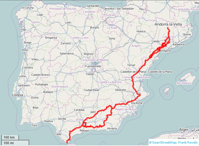
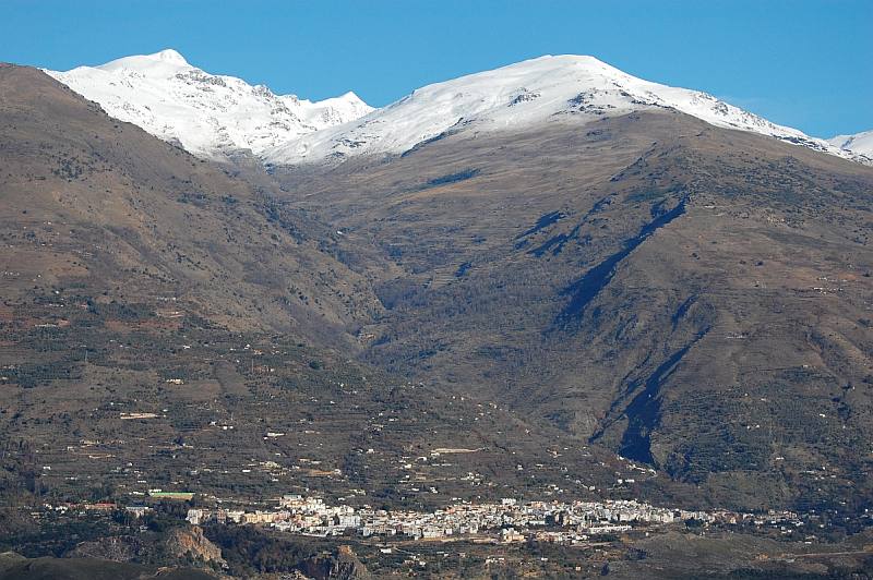
In Andalucía the trail forks off into two separate trails. One goes north of the Sierra Nevada and the other goes south of the mountain range but also passes straight over it from south to north at an altitude of 2000 meters. The paths split up in Villanueva de Cauche just past Antequera and rejoin in Puebla de Don Fadrique after some 500 kilometers. I myself have only experienced the southern path and from what I have heard from people that have walked both paths, the southern path is the best because it brings more excitement and beauty to the rambler than does the northern path and in addition the climate is dryer and milder in general south of the Sierra Nevada.
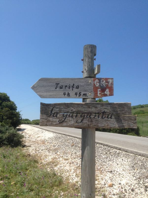
The GR-7 begins in the province of Cádiz in the city of Tarifa near Gibraltar in the Costa del Sol and touches the provinces of Málaga, Granada, Córdoba (northern path), Jaén (northern path), and Almería (southern path). You can find all the information you need on the trail in Andalucía in the excellent guide-book Walking the GR-7 in Andalucía. Detailed information on the complete GR-7 in Spain can be found at the web site Rutas y Viajes where you also can download the GPS-coordinates for all of the stages for free. I will confirm that most of the GPS files are valid and brings you safely to the target but at least two is outdated or erroneous and cannot be used.
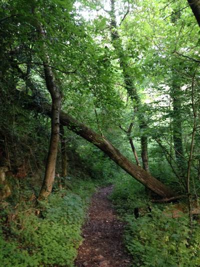
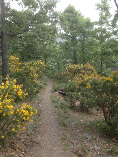
Walking the GR-7 generally speaking is hard work because Spain is the third most mountainous country in Europe only second to Switzerland and Austria but the trail also contains easier sections with level terrain through valleys with grazing cattle and swaying corn fields. You can find stretches like that in the Cádiz province for instance and in the autonomous region of Cataluña. But normally the GR-7 winds along rocky mountain trails with a difference of altitude of several hundred meters every walking day, quite often on forest trails, and sometimes on tarmac roads. The dirt covering the forest trails gets slippery as ice when it rains and the mud sticks to your boots where it rapidly creates a mud sole of several centimeters that forces you to stop every fifty meters or so in order to wipe it off.
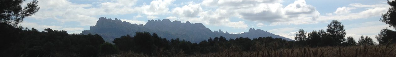
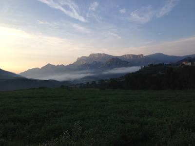
The most spectacular views and the most exciting walks in my opinion are to be found in the Alpujarras on the south slopes of the Sierra Nevada and in the Pyrenees when closing in on Andorra. GR-7 also runs through a big natural park in the autonomous region of Valencia but I didn’t follow the official path through that park because of water issues and therefore I cannot have any opinion about that.
I made a choice before beginning to keep high pace and to walk most hours of the day and when I summarized afterwards I had covered in average almost 40 kilometers a day and used 53 days to walk from Tarifa to Andorra la Vella. I also chose not to camp as a rule but instead as far as it was possible find a guest house for the night where I could have a good night’s sleep and a nice cooked meal. I carried almost 20 kilos including a tent and a sleeping bag but one of the most valuable things that I carried was a water bag with a suction nozzle that made it easy to keep myself from drinking too little. I started from Tarifa on May 9 and the temperature wasn’t too high, not in June either, but I wouldn’t recommend walking long stages in the southern parts of Spain from the second part of July until the second part of September as a rule. The temperature may easily rise to 40 degrees Celsius and above.
Another issue that can develop to a problem on certain stages of the GR-7 is to get hold of drinking water. I experienced that in the autonomous regions of Valencia and Cataluña and actually ran out of water completely at one occasion and had to ration it hard on another occasion. This incident became the reason for not following the official GR-7 through the huge natural park north of Tintoreto in Valencia but instead walk around it to the east. The water problem in Cataluña occurred in populated areas when walking through small villages that indeed had at least one public water fountain, but always with a sign that the water couldn’t be guaranteed to be of drinking quality. That actually was a common problem in many of the villages that I went through on my way following the GR-7 but normally I didn’t care because I carried plenty of water and in 50 of my 53 walking days this was more than enough because of the fairly low temperatures in spring and early summer.
I actually deviated from the official GR-7 route many times as I often found it too boring and uninteresting so I can’t say that I have walked all of the GR-7 but instead I have walked the more interesting My Own GR-7 🙂
If you can afford it and if you don’t want to spend all 24 hours of the day outdoors just for the hell of it I urge you to use the accommodation facilities that you pass by on your way forward. In almost every village however small, there is at least one place to stay and one place to have a meal.