The long-distance footpath GR 92 – Sendero del Mediterráneo is said to start in Portbou at the French border in Cataluña and end in Tarifa in Andalucía (or even in Cabo de Sao Vicente, Portugal’s Lands End, Finisterre, or Finistère) but there is no actual knowledge at all as of where the path is to be found in many places along that stretch so you often have to make your own trail up in order to patch things together. That hasn’t been a problem for me most of the time but at some occasions I have ended up on very busy roads and once I was forced to walk in the motorway for a couple of kilometers until I was told to get off it by two cops on MC 🙂
A funny thing happened in Valencia where I was told with certainty that the GR-92 to a great extent followed the old roman army road Via Agosto but sadly enough no one knew where that road went anymore 🙂
But the good news is that from Portbou all along the Costa Brava ,past Barcelona, and all the way to Ulldecona at the border between Cataluña and the autonomous region of Valencia the path is fairly well sign-posted most of the time but, you should of course carry a GPS-device with a Spanish topographic map in it and stuff it with as much detailed track information as you can find on the Internet, and you should also bring some sort of paper map (1:1000000 at least) in order to get the big picture as of what is in your neighborhood and what lies ahead of you, and last but maybe most important of all whether you are in a city or out in the wild – a good old compass – don’t put all your trust into your electronic devices that could be dangerous.
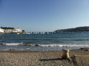
As usual when I am out walking for long distances I often deviate from the trail when I find it appropriate to do so. With the GR-92 I obediently followed the trail from Portbou to Blanes where the track is interesting and the seaside views astounding. You go through places like Cadaqués where Salvador Dalí had his residence and Roses with its huge sandy bay and you can feel the presence of the mighty Pyrenees at a distance. After Blanes the track turned inland but I continued following the coast and went straight through Barcelona, Sitges, Tarragona, Castellón de la Plana, and dozens of other nice seaside places on my way to Valencia instead of moving some miles into the countryside where the GR-92 is found.
I like the open space at the seaside maybe because I was born in a city by the coast and have lived close to the coast all my life. Another thing is that there is more people to chat with which is of great importance if you like me work hard on being able to speak fluent Spanish. On the other hand I am very comfortable walking by myself in the mountains not talking to another person for days.
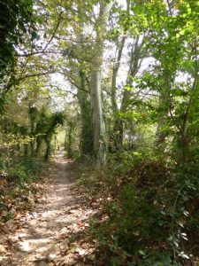
I have also bumped into signposted pieces of the GR-92 south of Torrevieja when heading into the province of Almería and yet another piece near Aguadulce on the south coast of Almería, but like I said in the beginning, the official GR-92 is v-e-r-y fragmented indeed.
Update November 2017: In October and November of 2016 I finished the parts of GR-92 (or let’s call it My Own GR-92 as it is uncertain in many places if the camino actually exist) that I hadn’t done before: from Valencia to Torre de la Horadada and from Puerto de Mazarrón to Málaga on foot and from Silves in Portugal to Málaga by bike.
South of Valencia heading for Silla-Sollana-Sueca-Cullera-
Continuing south and west through Múrcia to San Pedro-Cartagena-Puerto de Mazarrón-Águilas-San Juán de los Terreros-Carboneras-Nijas-Retamar-Almería-Aguadulce-Roquetas de mar-Almerimar-El Ejido-El Pozuelo-Motril-Almuñecar-Nerja-Torre del Mar-Málaga. Walking through the Almería region is both rewarding and nerve wrecking. There is a soap opera on Spanish television named Mar de plastico, Plastic ocean, that unfolds in the Almería farmland. This landscape is totally dominated by enormous greenhouses covered in plastic and fragments of plastic sheets are swirling around all over the place all the time. It is like walking in a wind tunnel walking between these endless plastic tents on both sides of the road. On the other hand, walking through the natural park of Cabo de Gata is a fantastic experience as is walking on the several miles long beach toward El Ejido with Sierra Nevada right in front of you for nearly an hour. That is meditation in motion 🙂 Once you head into the Granada region the greenhouses disappear almost instantly and completely. It feels like you can breathe freely again. When you reach the Málaga region the landscape becomes mountainous again right down to the coast. The three interlinked mountain chains Tejeda, Almijara, and Alhama with many peaks reaching over 1500 meters offer great trekking possibilities.
Málaga is a gem and a city to spend some time in. It´s center and historical area as well as the dock side and the beaches east of the center must not be missed.
Further east from Málaga following the coast you will pass Torremolinos-Benalmádena-Fuengirola-Mijas. Now you are in Costa del sol country as people imagine it. Sandy beaches, lots of tourists all year round, bars and cafés in abundance. From Málaga to Mijas you can walk quite comfortably by the sea but then it becomes more tricky and you have to face traffic for the most part of the way to Marbella-Estepona-La línea-Gibraltar-Algeciras. From Algeciras to Tarifa there is a great walking path with astonishing views of the Atlas mountains and North Africa as you close into the Straits of Gibraltar.
Going on north from Tarifa to Barbate (Trafalgar)-Chiclana-Cádiz-Jerez-Sevilla you will once again face a fair deal of road walking but not so heavily traficked. North of Cádiz there is a large national park that is perfectly possible to walk through by the sea on the beach at first and after the marshes ends also inland. The problem is that Guadalquivir, a big river, is in you way and the only way to cross it is by boat. I haven’t checked (as I did this stretch by bike and came from the north and couldn´t ride the bike on the beach south of Matalascañas) but it is possible that some fisherman could ship you over to the other side from Sanlúcar. The only other option as I know it is to cross the river by a bridge in Sevilla.
I can assure you that the Cádiz region is a blowhole much appreciated by surfers and kite riders and not so much by bike riders. I have been told that the cows in Cádiz are very reluctant to stand up as they risk being blown down by the wind.
After Sevilla you have to find your own way to Alcoutim in Portugal as that is the place you have to go to in order to cross another big river, Guadiana. Here is a link to John P’s suggestions. I rode a bike and chose to go via Benacazón-Hinojos-Almonte-Huelva-Gibraleón-San Bartolomé-Castillejos-Sanlúcar (but in the opposite direction). A rather hilly ride north of Huelva but a nice environment to be in. In Alcoutim I found the Fun River company that swiftly shipped me and my bike over to the other side of Guadiana for 2 €. If you are walking you probably want to continue from Alcoutim on the Via Algarviana that ends in Cabo de Sao Vicente. As I have mentioned before I drove my bike in the opposite direction and reached Alcoutim after having started in Silves (where I left the Via Algarviana on a previous walk) and then passing through Albufeira-Faro-Olhão-Tavira-Vila Real before reaching Alcoutim.


