Today’s hike (May 12 2014) was relatively easy to begin with but all that changed when I chose to follow my GPS when it suggested a different route from that of the guide-book. The GPS route took me for a walk through vast fields covered with bushy herbage growing chest high and it forced me to lift my feet high for every step I took in order for them not to get caught in the undergrowth with a headlong fall as an immediate result, cruelly pushed down to the ground with force by my backpack.
After having struggled through these horrible fields I went past a small group of houses where a white horse got trapped between me and a gate that I wanted to pass through, and it took quite some time before I could convince the horse to move towards me and then past me as it was quite jumpy. After climbing a couple of high fences and crossing a creek I finally re-connected with the track from the guide-book and from there I had a pleasant walk for the rest of the afternoon until I made my way up the last hill where Jimena de la Frontera resides.

I got a room at Casa Henrietta and had a superb omelet with fresh, gigantic, mushrooms, and a huge salad at a restaurant at the town square.
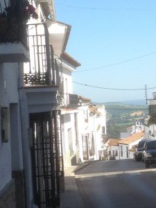
Jimena is another one of those many beautiful, relaxed, and friendly places in Spain that also offers magnificent views.
Walking the GR-7 in Andalucía:
Dominated by its castle, an Arab fortress built on Roman ruins, Jimena is a delightful ancient village built on a steep hillside and looking down over fertile green valleys with orange groves and cork forested hills. Many British residents enjoy its sunshine and relaxed pace of life. From the castle you can see as far as Algeciras and Gibraltar.
